The Taroko Gorge, inside the National Park, is among the three most talked about and rated “must visits” when sightseeing in Taiwan, with the other two being Sun Moon Lake and Alishan. This trip we’ve settled for two out of the three, having dropped Alishan from the itinerary altogether as it would have taken up just too much time driving to and fro from our base in Taichung. I’d found Sun Moon Lake somewhat disappointing — it felt touristy, crowded, and too mass-market, and the lake itself not finally that different from other self-contained large bodies of water I’ve seen elsewhere. Thankfully, the sights I witnessed at Taroko Gorge on Day 7 were far more memorable.
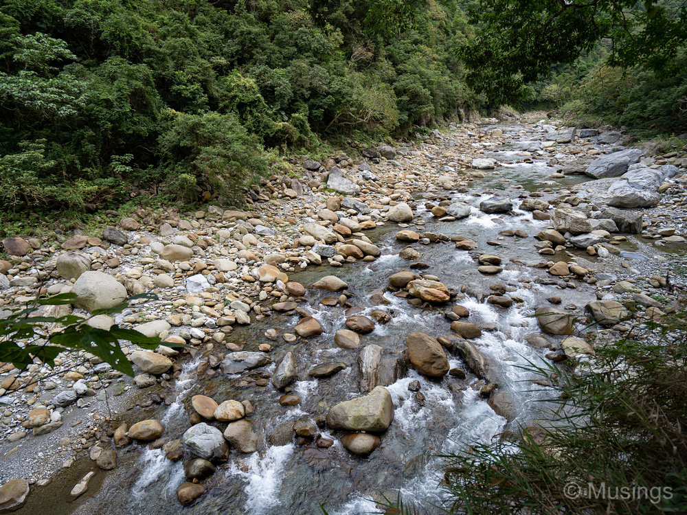
A bit about the Gorge itself. It was first formed when marble was thrown up through the clashing of tectonic plates millions of years ago. Over time, the waters of the Liwu River slowly eroded the surface, leading to the valley today that is as deep as 300m in spots. It actually continues to deepen by about 5mm every year!
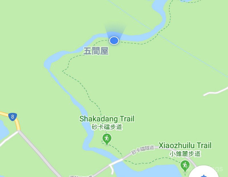
The day trip to the Gorge was planned with the end in mind: our returning leg from Hualien to Taipei was at 2:40PM, so we worked back from that, and were lucky enough to find a Hualien-based driver who was willing to start the trip at 6:30AM so that we could maximize the daylight hours we had in Hualien. That was pretty much the right decision with hindsight: we got to Taroko National Park at 7:30AM — stopping for a quick breakfast first too — at least an hour before the first other visitors arrived. That meant we pretty much had the first trail — the Shakadang Trail — to ourselves. And even as the early morning stretched into mid-morning at around 10AM after we finished the trail, crowds were still fairly sparse and I was able to frame other humans out of the pictures for the most part.
Our driver, Tony, brought us to quite a few stops in the park, but the two highlights were:
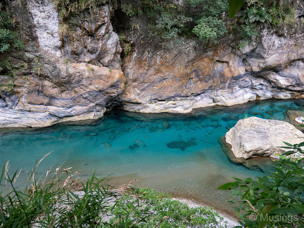
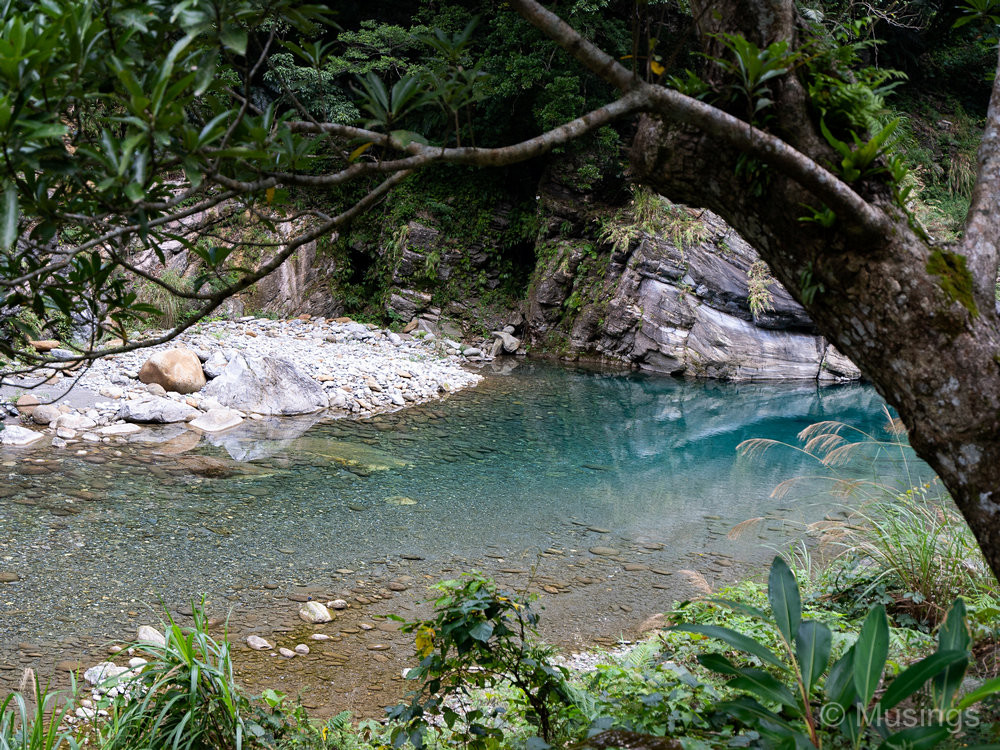
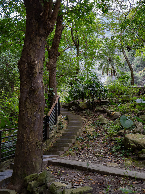
The Shakadang Trail — a fairly easy-to-walk trail that runs for 4.4km before most visitors have to turn around and walk back the same distance. We got as far as the aqueduct segment, which is (my best guess) about 1.8km, then turned around. We took it quite easily to take in the sights, stopped at various points to take pictures, and finally another 20-minute break at the aqueduct for H and P to play at the river’s bank. We started at 7:45AM, and got back to the start point at 9:35AM — making our trek just under two hours. We had the outbound segment of the trail to ourselves, and only started encountering other visitors on our return leg.
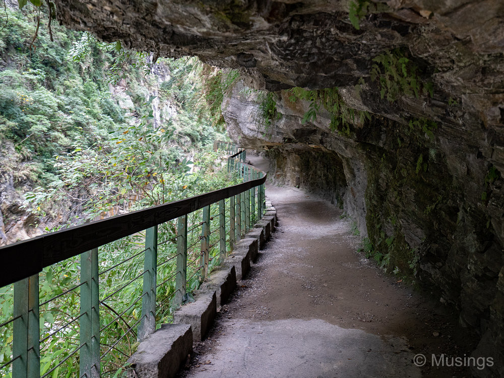
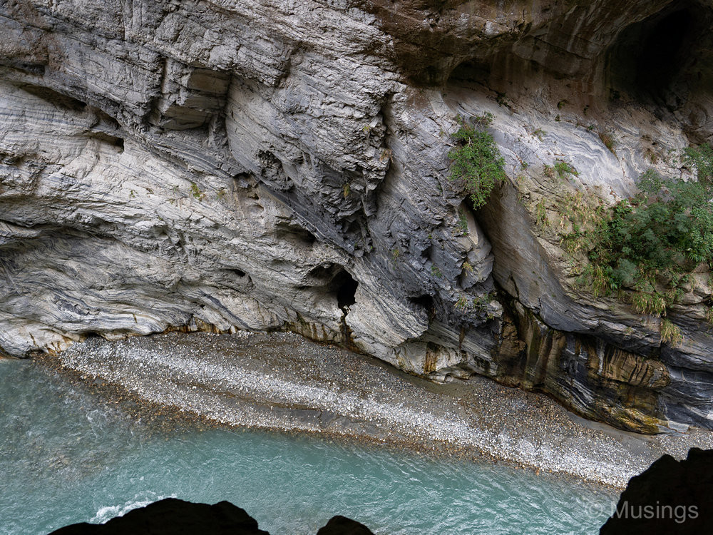
Swallow Grotto — the other must trek when visiting the park. I think most visitors will do just the 600m or so segment which sees visitors walking through several tunnels that are inside the cliff, and you get amazing views of the opposite cliff and the sheer vertical drops to the running river below.
Pictures: the vista-type images were taken using the Sony FE 16-35mm f4.0 and a few on the Sony FE 24-105mm f4.0; panoramas using the Samsung Note 9; and the kids at play using the Tamron 70-200mm f2.8. Starting off with the Shakadang Trail, and especially its stunningly clear turquoise waters:
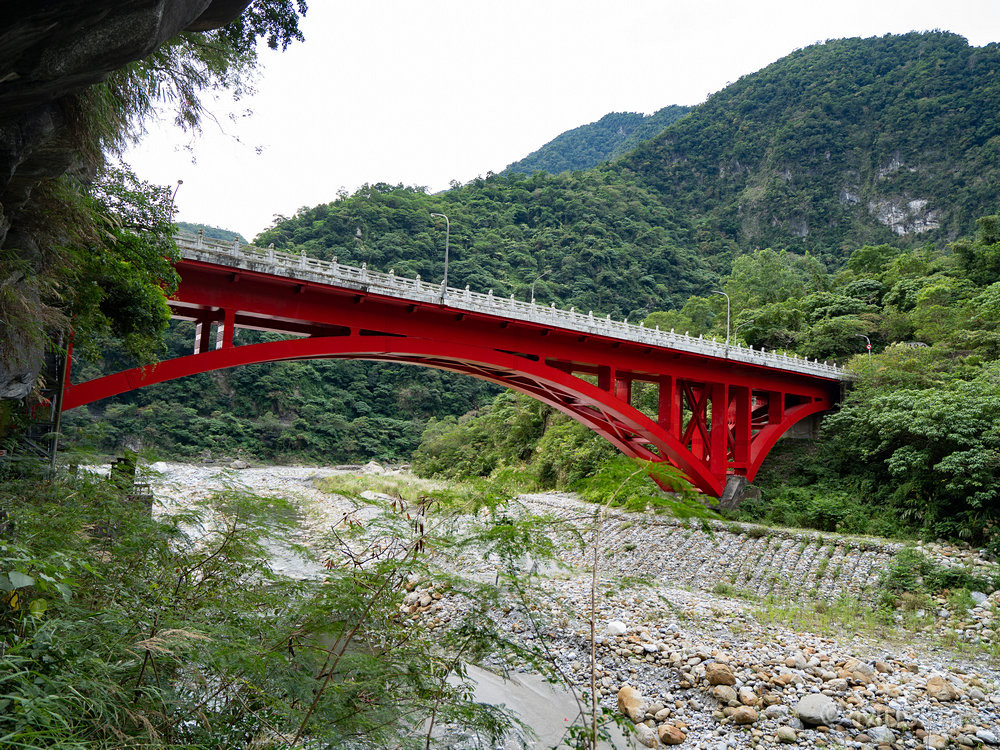
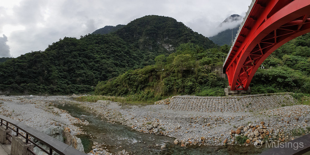
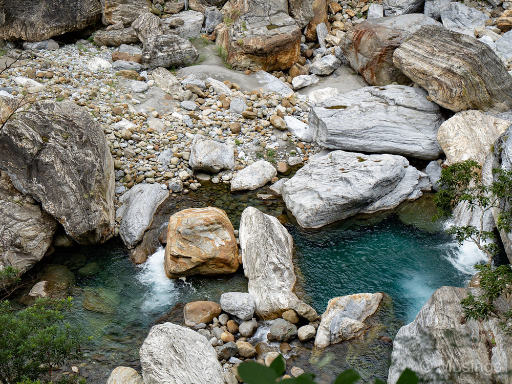
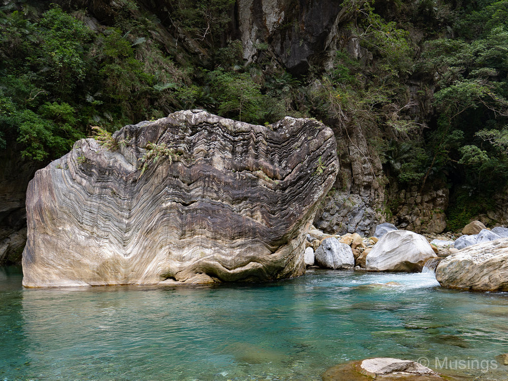
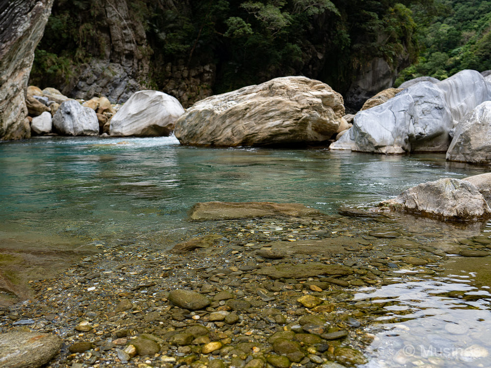
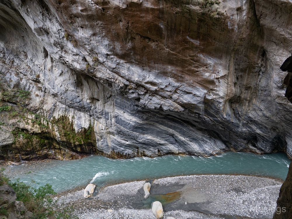
Near the start of the trail, and Shakadang Bridge with its iconic deep red steel support structure.The start of the trail is just a few minutes from the entrance and visitor information center. There is vehicle parking just after this bridge, though it can get quite congested on crowded days — given that the car park itself isn’t that big. There are toilet facilities in the car park too.The trail runs beside the river, though you’d need a focal length of around 80mm onwards to get zoomed-in shots of the turquoise waters.The trail is well paved and flat for the most part. There are a few parts where taller visitors might need to duck slightly. I had no problems walking the trail with my 1.7m height. There are numerous motorbikes and small lorries that go up and down the trail though, but they make such a massive din that you can easily hear them from a distance away, so that you can get ready to make way for them.Love the waters!This is a cropped picture as I wanted the overarching tree on the right to frame this composition.Unless you have ninja-like skills, you can’t actually get onto the Liwu River itself for the most part. Past the fencing on your left, you’d need to navigate a couple meters of vertical drop. There are bits though where the trail is basically adjacent to the river without much height difference, but there are a lot of signposts warning of the dangers of trying to climb over.The aqueduct, about 1.8km in. We got as far as about here after about an hour and ten minutes of walking in, though we really took our time.A rock with a face that looks almost like a mural painting, but the patterns are caused by natural forces.This is slightly off the trail, but it seemed quite safe — even for the kids — so we got off it and spent some time by the banks of the river. The photos of that little play activity are in the next post.There’s some mobile coverage quite a bit into the trail. Even if not, there’s still GPS!
And at Swallow Grotto:
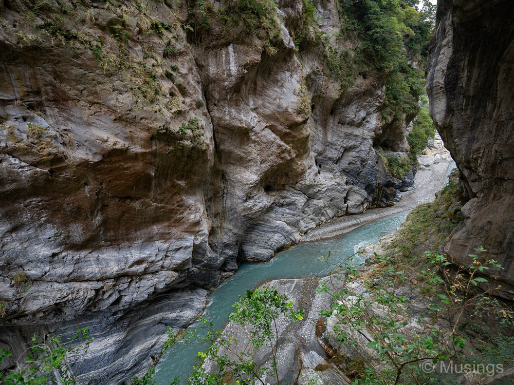
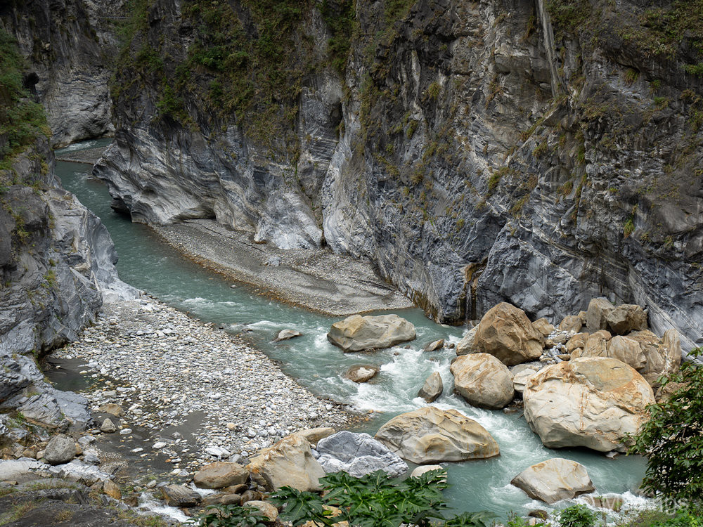
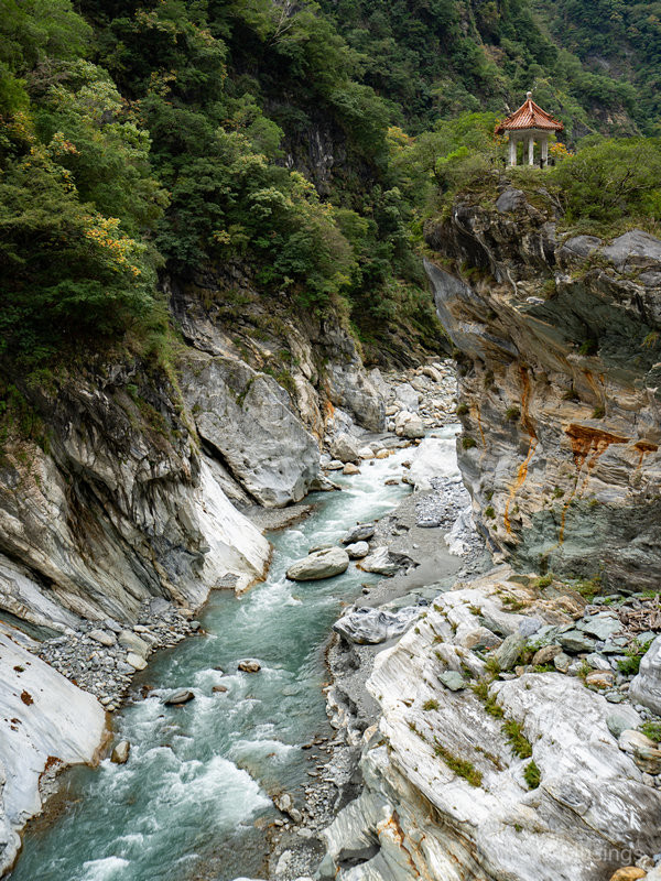
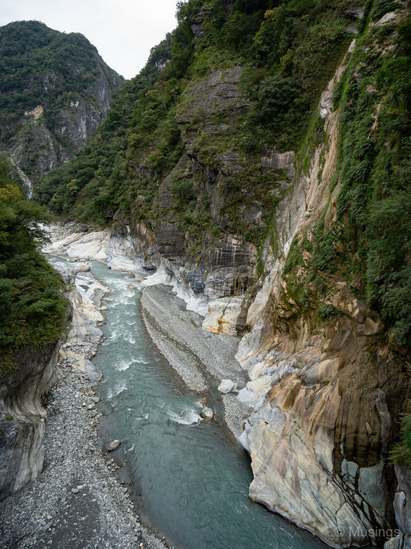
The Grotto overlooks a narrow section of the gorge, and it’s a sheer vertical drop of maybe ten or more meters on your right. So, plenty of warnings against trying any kind of stunts — you would not survive a fall!The Grotto is so named by the locals as the rock formations on both sides of the river contain small caves that were once nesting places for swallows. The birds have long left the area though because of mass tourism.For vertical orientation shots, I reckon any lens with a 24mm focal length (35mm equivalent) will do, but to capture in landscape mode the winding river as it curves around the gorge, you’d need a wider lens. All of the photos taken in the Grotto were taken using the Sony FE 16-35mm f4.0.Looking straight down towards the river. A little scary for me with my height phobia!About halfway into the trek along the Grotto. Our guide and driver, Tony, informed us that the rock faces on the bottom right resemble Indian warriors, and even had an annotated picture to show it. But I couldn’t see it! Probably too cross-eyed.This spot offered really good perspectives of the gorge and how much water movement in the river has eroded over the last thousands of years to its current depth.No more swallows remain in the Grotto, sadly.
And at other spots — I’ll gradually insert captions to each picture best I can once I figure out the names of the places we stopped at!
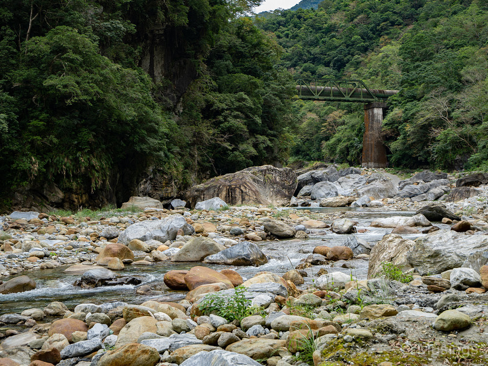
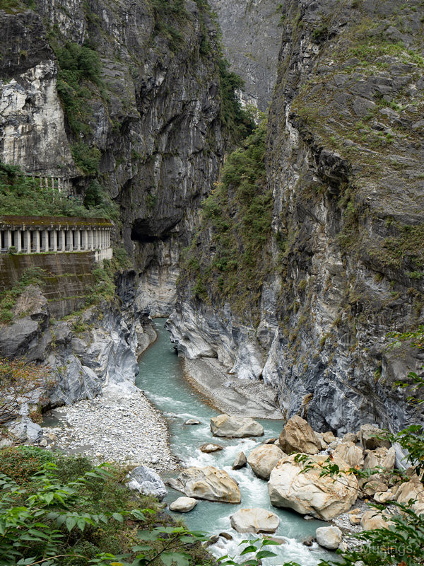
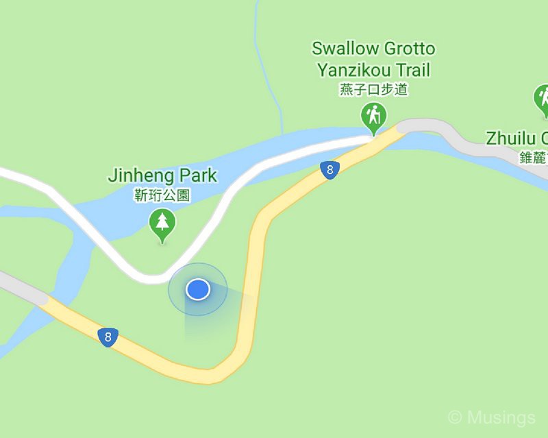
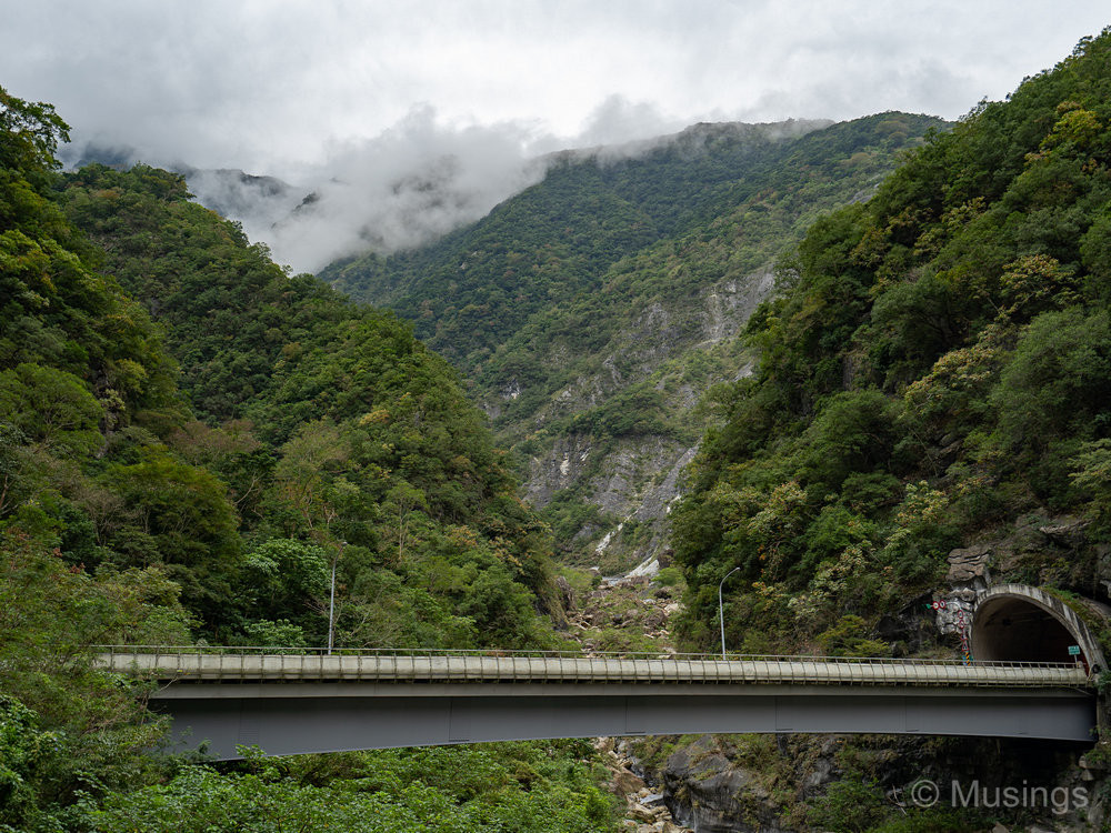
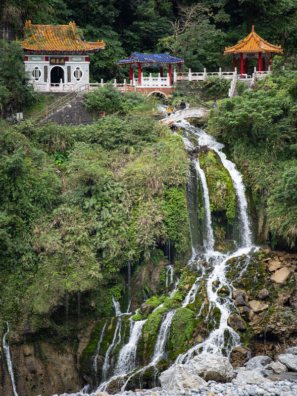
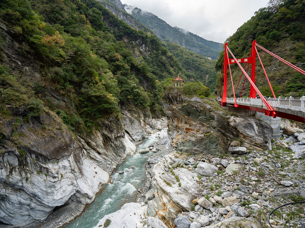
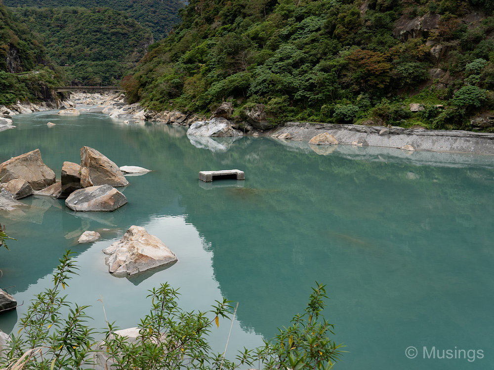
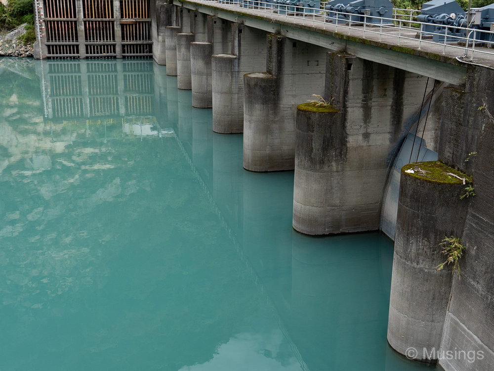
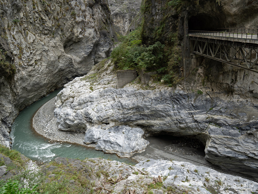
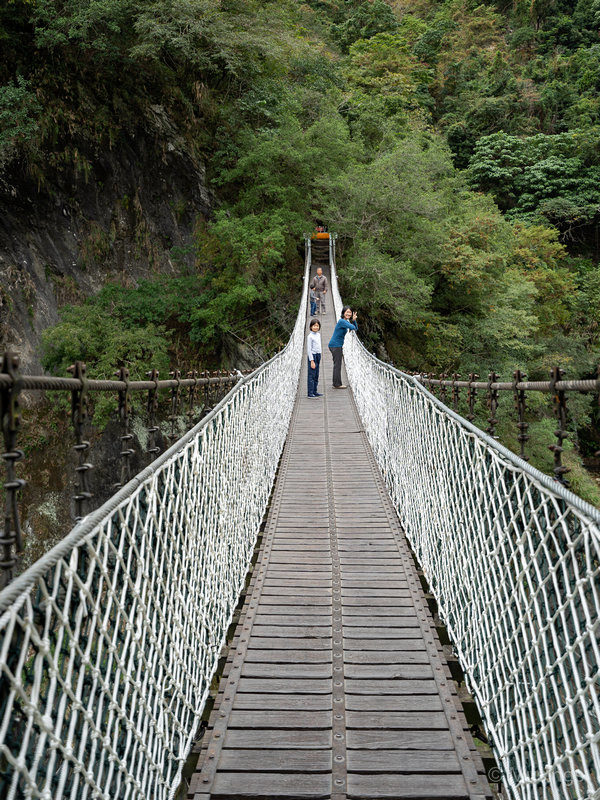
A mist layer at the peak of the mountain range.The Eternal Spring Shrine, a monument built in 1958 to remember the several hundred laborers who died building the Central Cross-Island Highway that connects the east and west sides of Taiwan.Cimu Bridge, or Motherly Devotion Bridge. This is the spot for you to capture pictures routinely seen in brochures and travel magazines. You’d need a fairly wide-angle lens though to replicate those images, but it’s otherwise an easy enough capture, with the usual weather constraints applying.There’s a little viewing pavilion beside Cimu Bridge that’s accessible from the left, though the view isn’t very different from what you’d get on the ground. It’s an easy climb nonetheless with steps.Still waters stopped by the dam.No water movement — serenely still.At the Liufang Bridge point, I think. This is reportedly the best viewing spot to see the Gorge. Notice how it does a tight 90-degree turn. There’s a built-up viewing platform that was uncrowded at the time we were there — but from others’ pictures, the place can get really congested!Jin Heng Park. There is a sculpture here remembering the engineer who was killed during the construction of the highway, hence his namesake for this small park.The suspension bridge that I read is part of the Lushui Trail. We didn’t have time to do this trail though, so just took a look at the bridge. The bridge is rock solid though if you have jokers doing stunts on it, it’ll shake quite a bit! We had a small window of a few minutes where we were the only visitors on it, but shortly thereafter the hordes arrived.View of the gorge from the suspension bridge.
We left the Gorge at about noon for Qingshui Cliffs next. Though with the benefit of hindsight, we should have dropped the cliffs and stayed a little longer at Taroko Gorge.

Recent comments