The last couple of days sort quite a bit more intensive planning for our Jeju itinerary, and that in turn led to a number of changes. Some of the key changes and updates included:
Rechecked and optimised our routes for each day to make sure there wouldn’t be unintentional backtracking.
Between Aewol and downtown Jeju, we decided to stay in the latter. We found an Airbnb apartment that was in the Dongmun market vicinity – hooray!
Reviewed our timings to watch the Haenyeo divers @ Umutgae Beach to take advantage of where we would be staying in Seopikoji, and added two timings on two different days to try to catch the divers in action. Especially since whether one would be able to see the divers really depended on the weather of that day.
The wife also really wanted to see Hydrangeas, one of the highlights of any Jeju visit in June. We found three locations which are reportedly great to find them: Halim Park, Gimmyeong Coastal Path, and Saryeoni Forest Road – and reworked the itinerary to include all three.
Another highlight of this visit would be to see fireflies. OK, so whether one would be able to actually see them depends on a lot of things, but we amended the itinerary to allow us two days where we could go the forest where they are most commonly spotted and try our luck.
ChatGPT also again proved tremendously useful – though with caveats (see below) – in checking for these and churning out analyses:
Identifying which locations would likely be OK to fly drones.
Checking which places have admission charges, how much they are, and whether discounts are available if we booked admission tickets online.
For morning activities, checking to make sure these places are actually opened by the time we get there.
For scenery sites, checking what are the best timings to visit – e.g. for sunrises and sunsets – and verifying if we would be visiting at the best times.
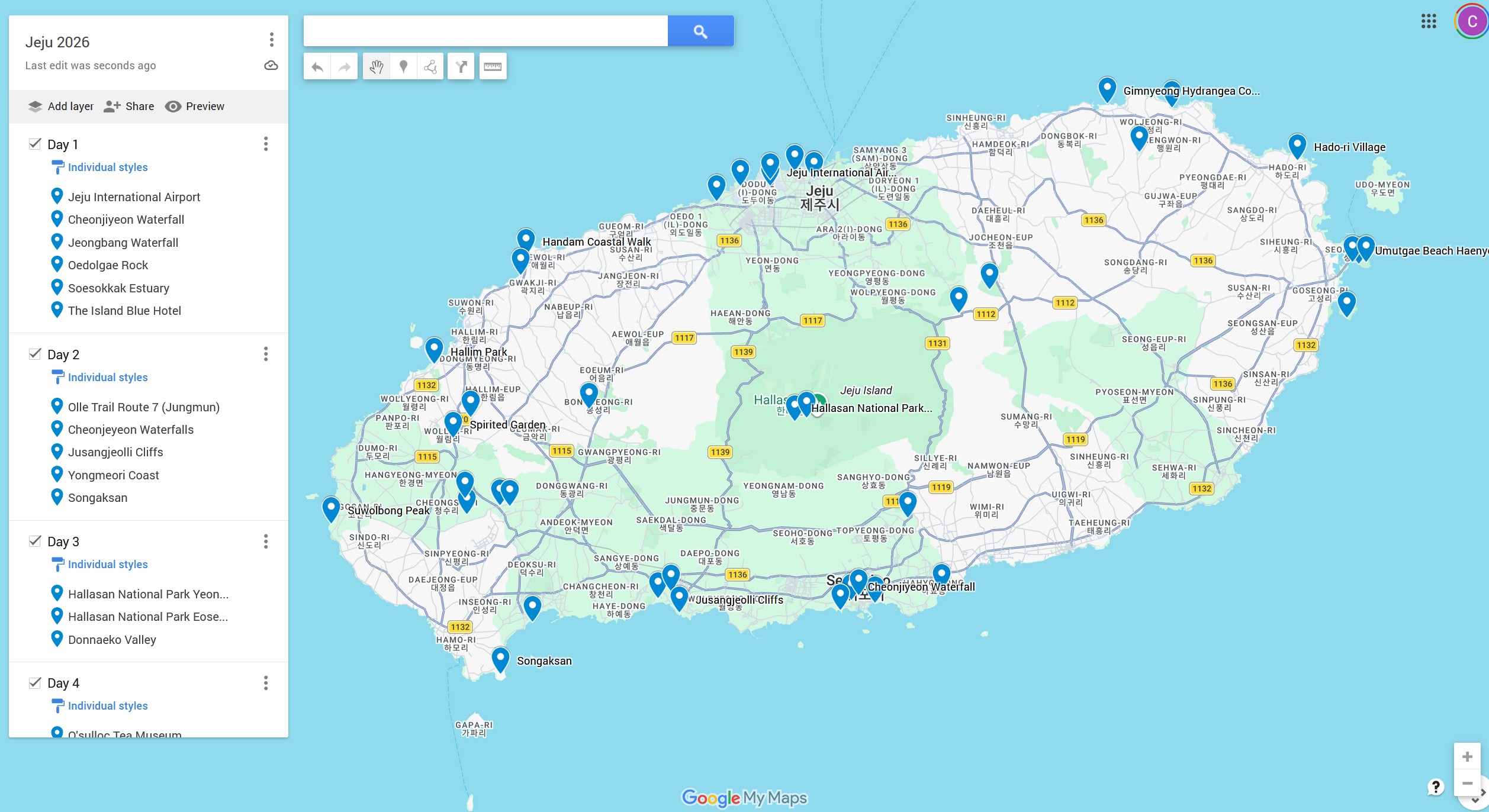
Creating CSVs for each itinerary day for me to import into Google Maps to create an overall travel map.
Though now that I’ve spent a fair bit of time working ChatGPT pretty hard for this itinerary, here are the caveats to which I had to always keep in mind:
It’s fully capable of making mistakes, e.g. re-adding places that I’m already visiting or stating that drone flying is permitted in locations when they are clearly not. Yep, unimaginable: this is software that should not be erring, is it not?
It just cannot produce good visual maps. Apparently, it’s because these tools can only create illustrated generative images, and not true geographic maps. So, mistakes include cities in the wrong places, misplaced coastlines, inventing new locations.
My conclusions on ChatGPT as a travel assistant:
It’s great for formatting and styling plans.
It’s great for aggregating, summing and calculating with hard data and numbers, e.g. the total amount of time I’d be spending visiting over this itinerary, or calculating the ratio of driving against visitation times.
It’s great for generating customised instructions to the private driver we’ve engaged.
It’s pretty good at finding hard to spot typographical errors. Or maybe it’s just me and my getting poorer eyesight?!
It’s somewhat good at finding inefficiencies in my plans, and proposing alternatives.